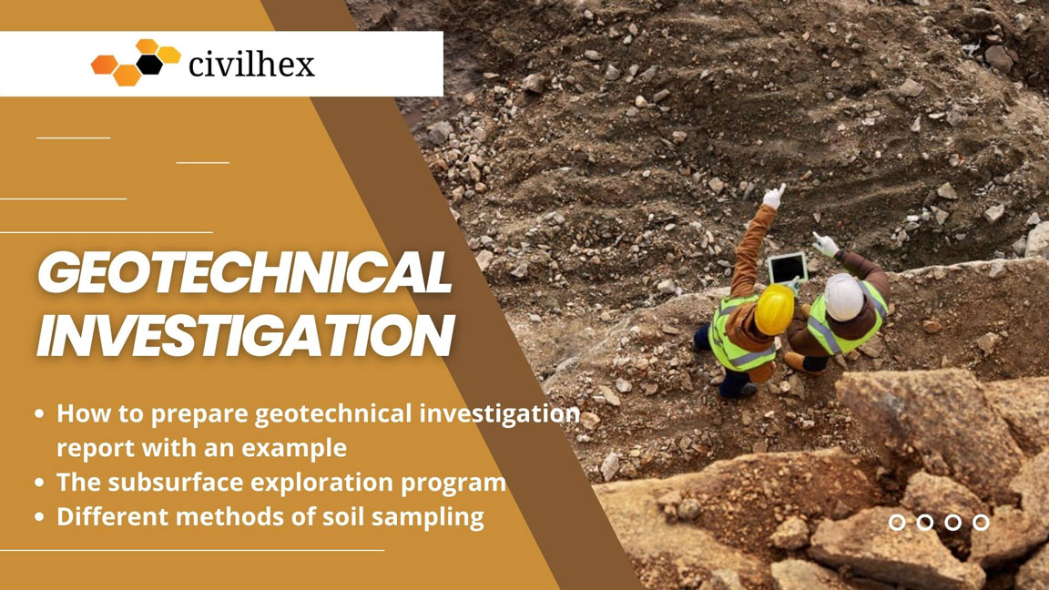
Geotechnical investigation is also known as site investigation or soil exploration. In this article, we explain in detail how to prepare geotechnical investigation report pdf with an example, Boring logs sample, the subsurface exploration program, and different methods of soil sampling.
Geotechnical Investigation
Geotechnical investigation is the process of investigating a proposed construction site for determining the layer of natural soil deposits that will underlie a proposed structure and their physical properties assessing and reporting information and data regarding the site is generally referred to as geotechnical investigation or site investigation and some time is also called soil exploration.
Geotechnical investigations are performed to determine if the site is suitable for construction. These types of investigations are necessary before any foundation work begins. There are different methods that can be used to perform geotechnical investigations such as geological and geophysical surveys, in-situ testing, boring and sampling, visual inspection, local experience, laboratory testing of soil samples of the subsurface materials, groundwater observation, and measurements.
One of the most popular methods is called Rotary drilling. Rotary drilling involves taking samples of the ground using a hollow drill bit. These samples are then analyzed to determine what type of soil is present at the location. If the results show that the soil is not suitable for construction, then some design changes should be made.
See this video:
Purpose of Subsurface Exploration
Subsurface exploration is the process of finding out what lies beneath the surface. It is done to help engineers understand the geological formations and structures that lie below the ground. Subsurface exploration helps them determine if there is any potential risk to the stability of buildings or other infrastructure.
The purpose of subsurface exploration is to obtain information that will help the geotechnical engineer in –
- Selecting the ideal type, shape, and depth of foundation that is suitable for a given structure.
- Estimating the load-bearing capacity of the foundation.
- Estimating the probable settlement of a structure.
- Determining the potential risk of foundation such as collapsible soil, sanitary landfill, expansive soil, and so on.
- Establish the methods of construction for changing the subsoil conditions.
- Prediction of the lateral earth pressure for structures such as sheet pile bulkheads, retaining walls, and braced cuts.
- Determining the location of the water table on the ground.
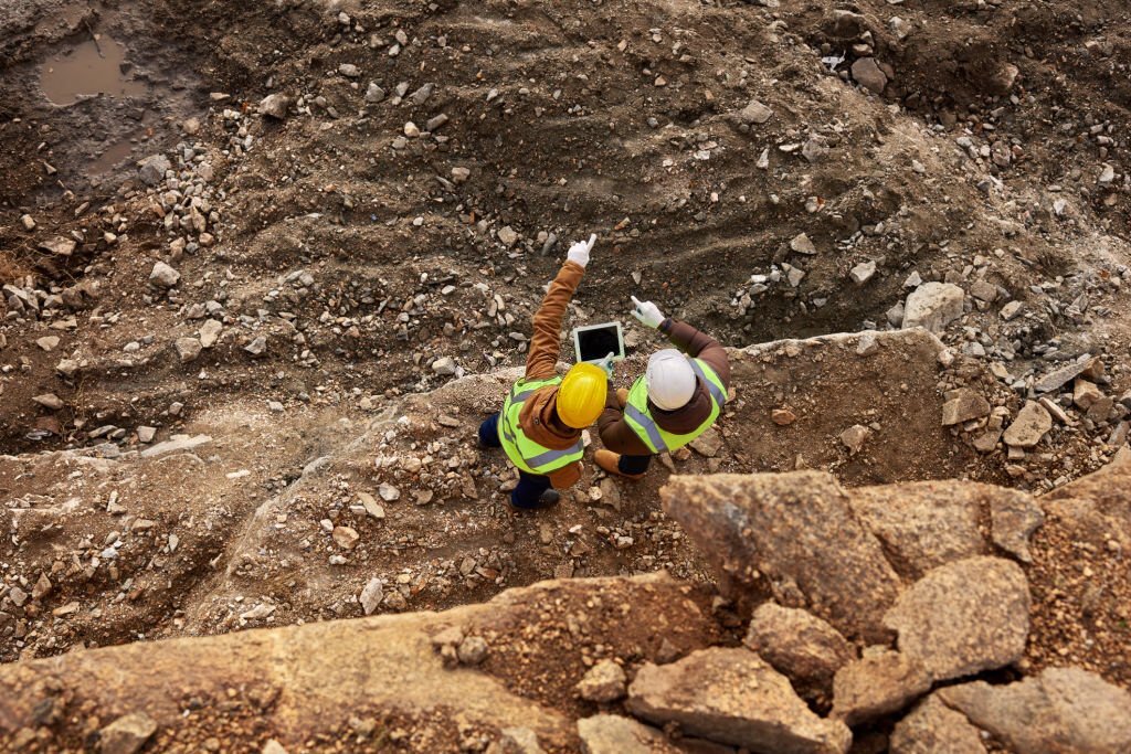
Subsurface Exploration Program
There are three types of subsurface exploration programs:
- Preliminary information
- Reconnaissance
- Site investigation
Preliminary Information
In this stage, engineers are obtaining information regarding the type of structure to be built and its general use. For the construction of buildings structures, the approximate column loads and their spacing, basement requirement, and local building code requirements should be known while the construction of bridge structures requires determining the length of spans and estimating how much load will carry on piers and abutments.
Site topography and type of soil to be encountered near and around the site which is proposed can be obtained from the following source:
- United States Geological Survey maps.
- State government geological survey maps.
- United States Department of Agriculture’s Soil Conservation Service County soil reports.
- Agronomy maps published by the agriculture departments of various states.
- Hydrological information published by the United States Army Corps of Engineers, including records of stream flow, information on high flood levels, tidal records, and so on.
- Highway department soil manuals published by several states.
- Google Map
Planning a site investigation, the information from these sources can be extremely helpful.
Reconnaissance
In this stage, engineers make a visual inspection of the site to gather information about –
- Inspection of the general topography of the site, the probable existence of drainage ditches, abandoned dumps of debris, and other materials present at the location of the site. Moreover, cracks caused by shrinkage and creep of slopes at regular intervals may be indicators of expansive soil.
- Soil stratification from deep cuts, may be required for the construction of nearby highways and railroads.
- Inspection of site vegetation, which may indicate the nature of the site soil. For example, a mesquite cover in central Texas may indicate that the site soil nature is clay which may create some problems in foundation construction.
- Nearby Buildings and Bridge abutments with high-water marks.
- Determined the site groundwater level by checking nearby walls.
- what type of construction nearby done before and the existence of any cracks in walls or other problems.
- The formation of rock which is visible on the site surface.
The stratification nature and the physical properties of the soil nearby also can be collected from any available soil-exploration / geotechnical investigation reports on existing structures.
Site Investigation
In this stage of the soil exploration program, geotechnical engineers are planning, making boreholes test, and collecting soil samples at desired intervals which describe in the standard for subsequent observation and laboratory tests. However, the approximate minimum depth of the borings is also determined in this stage which we can explain and give you the detailed procedure in here: “Depth of Boring and Borehole Spacing for Soil Investigation”
Different types of soil boring:
- Auger Boring
- Wash Boring
- Rotary Boring
- Percussion Boring
Here is a detailed article about different types of soil boring in the United States and their procedure.
Procedures for Sampling Soil
There are two types of soil samples collected during the subsurface exploration:
| Type 1 | Type 2 |
|---|---|
| Disturbed soil sample | Undisturbed soil sample |
Generally, disturbed soil samples are used for laboratory tests, but it should be representative. Soil samples are mainly used for the following types of laboratory tests:
Types of laboratory tests of soil:
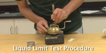
- Determination of liquid and plastic limits
- The specific gravity of soil solids
- Grain-size analysis
- Determination of organic content
- Classification of soil
Note that disturbed soil samples cannot be used for consolidation, hydraulic conductivity, or shear strength tests.
See this video: Atterberg Limit Tests of Soil
Method of soil sampling and tests:
- Split-Spoon Sampling and Standard Penetration Test (SPT)
- Sampling with a Scraper Bucket
- Sampling with a Thin-Walled Tube
- Sampling with a Piston Sampler
- Observation of Water Tables
- Vane Shear Test
- Cone Penetration Test
- Pressuremeter Test (PMT)
- Dilatometer Test
- Iowa Borehole Shear Test
- K0 Stepped-Blade Test
- Coring of Rocks
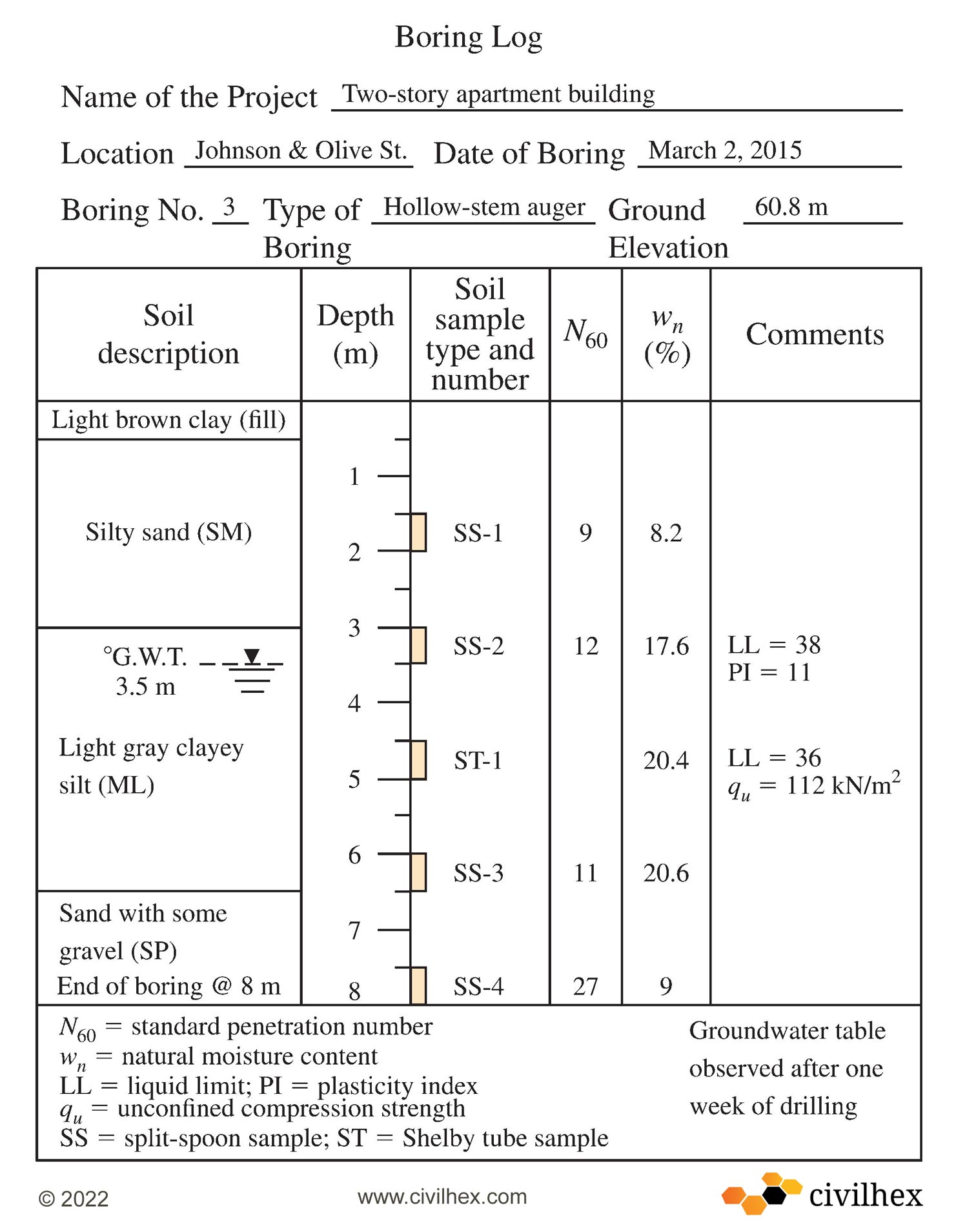
Preparation of Boring logs
The detailed information gathered about each borehole is presented graphically in a form called the boring log. The driller basically should record the following information in a standard boring log:
- At the top drilling company name and address
- Driller’s full name
- Job description and number of the project
- Number, type, and boring location
- Date of boring
- The visual structure of subsurface/subsurface stratification can be obtained by visual observation of the soil brought out by auger, thin-walled Shelby tube sampler, and split-spoon sampler.
- Observation site groundwater table and date, use of casing and mud losses, and so on
- Standard Penetration Resistance and depth of SPT
- Write the number, type, and depth of the soil sample which collected from boring.
- If there used rock coring then mention the type of core barrel used and, for each run, coring actual length, length of core recovery, and RQD
Working on such kind of project, the data should never be left to memory, if doing this, it’s a high chance of getting errors in boring logs which is highly risky.
Geophysical Exploration
There are several types of geophysical exploration techniques are introduced which is a rapid evaluation of subsoil exploration. This technique is usually used for large areas because it allows rapid coverage and is less expensive than the traditional exploration method by drilling. However, in many cases, it is difficult to interpret the result precisely. For that reason, these techniques should be used only for preliminary work. Here, we discuss about three common techniques of geophysical exploration:
Geotechnical Investigation Report (PDF)
Once every stage is completed of all soil exploration programs then its subject to visual observation and proper laboratory testing for the soil and rock specimens which is collected from the field test. Finally, all the required information has been assembled. Generally, soil exploration report is prepared for use in construction projects by the design office and for reference during future construction work at that location. Depending on the structure under consideration and the person who prepared the report, such report may vary in the details and sequence of information. However, each report must include the following items:
- Investigation description
- Structure description for which the subsurface exploration has been conducted.
- Site location description, including nearby structures, the nature of the vegetation on the site, drainage conditions, and any other feature unique to the site.
- Site geological setting description.
- Field exploration detail overview such as type of soil borings, number of borings in the site, depth of borings, and so on.
- A general description of the subsurface conditions, as determined from soil samples and from laboratory tests, standard penetration test, cone penetration resistance, and so on.
- Water-table condition which is the most important one.
- Recommendations regarding the foundation, which type of foundation is suitable for the soil, the allowable bearing capacity, and any special construction procedure that may be needed or not. Even alternative foundation design procedures should also be discussed in this section of the subsoil exploration report.
- Lastly, Conclusions and limitations of the geotechnical investigation.
Download: Geotechnical investigation report PDF
The following graphical presentation must be attached to the geotechnical investigation report:
- Site location map
- A detailed plan view of the boring location with respect to the proposed structure and those nearby areas
- Borings logs
- Results of laboratory test
- Other important graphical presentations
The geotechnical investigation report should be well structured and documented, as it will help to solve foundation construction problems and help in answering questions related to this.
We are sharing with you a professional Subsurface exploration and geotechnical investigation report which is prepared by A1 Consulting Group, Inc. Consulting Engineers, Surveyors, Planners, Construction Managers, 117 International Drive, Morrisville, NC 27560, USA
Conclusion:
Every civil engineering project is built on the earth’s surface, so it is mandatory to investigate the subsurface of the earth to know if the proposed structure can be built. Subsoil exploration is an integral part of all civil engineering projects, and the program is done under geotechnical engineering. Geotechnical investigation is carried out during the very early stages of civil engineering projects in an attempt to adequately define the subsoil conditions and the design parameters of the various soil strata.
The soil exploration method includes visual inspection, in situ tests, sample collection, and laboratory tests. There is a substantial cost linked with the subsurface exploration program and budget limitations often restrict the extent of the soil exploration.
In situ test means inserting a probe into the ground and penetrating it by using a specific standard hammer and measuring the resistance, which is directly related to the soil stiffness and strength. The Standard penetration test (STP) and cone penetration test (CPT) are the two major in situ tests. In the United State of America, these two tests are commonly used in geotechnical engineering projects.
The vane shear test is very effective in determining the undrained shear strength in soft clay. However, there are two more specialized tests available that are becoming popular which are the pressuremeter test and dilatometer test.
The Geophysical Exploration method can also be used for soil exploration, as well as for determining the subsoil layer and shear wave velocities. This method is effective in covering large areas.
Reference:
- Principles of Foundation Engineering (Ninth edition, 2019), “Braja M. Das, University Sacramento”, “Nagaratnam Sivakugan, College of Science & Engineering James Cook University”
- American Society for Testing and Materials (2001). Annual Book of ASTM Standards, Vol. 04.08, West Conshohocken, PA.
- American Society for Testing and Materials (2016). Annual Book of ASTM Standards, Vol. 04.08, West Conshohocken, PA.
- American Society of Civil Engineers (1972). “Subsurface Investigation for Design and Construction of Foundations of Buildings,” Journal of the Soil Mechanics and Foundations Division, American Society of Civil Engineers, Vol. 98, No. SM5, pp. 481–490.
- Anagnostopoulos, A., Koukis, G., Sabatakakis, N., and Tsiambaos, G. (2003). “Empirical Correlations of Soil Parameters Based on Cone Penetration Tests (CPT) for Greek Soil,”
- Geotechnical and Geological Engineering, Vol. 21, No. 4, pp. 377–387.
FAQ
How geotechnical investigation carried out?
Geotechnical investigation is carried out during the very early stages of civil engineering projects. There are different methods that can be used to perform geotechnical investigations.
These methods are:
1. Geological and geophysical surveys
2. In-situ testing
3. Boring and sampling
4. Visual inspection
5. Local experience
6. Laboratory testing of soil samples
7. Groundwater observation
Finally prepared the geotechnical investigation report.
When is a geotechnical investigation required?
All Civil Engineering projects require geotechnical investigation at the initial stage of any construction, to determine whether the proposed structure can be built at the site or if any other special measures need to be taken.
Why geotechnical investigation is important?
All civil engineering projects build on the surface of the earth so it is highly risky to build structures without knowing the subsoil condition.
Geotechnical investigation is important to know the answers to the following questions:
· Can the load of the proposed structure properly take the soil at the site?
· What is the bearing capacity of the soil?
· How is the groundwater table condition?
· What type of foundation should be used?
· How about the size of the foundation?
· How deep should the foundation be placed?
Without geotechnical investigation, you can’t be able to answer those questions, so geotechnical investigation is very important.
Can a geologist become a geotechnical engineer?
“NO”, Geologists are scientists who study the Earth, its history of creation, nature, materials, and processes. On the other hand, a geotechnical engineer is a civil engineer who specializes in ground soil, to build a civil structure on it.


